Monday, September 14, 2020

PCT 2020 part 1 Start (0/Aprl 29) to Kennedy Meadows South(680.8/May 30).

Before I start to tell of my adventure on the Pacific Crest Trail I would like to thank some people for helping make this journey a little easier. Laurie for helping with all the resupply. This saved me a lot of time out there. John for picking me up at Harts Pass in WA and giving me a ride home. John, Linda, Roger, Laurie, Scott, Leila and my daughter, Brenda and her family for coming to see me and bring me treats at some of the road crossing. As you can imagine, the same diet for months on end can get dull. Last, I would like to thank all the people I meet on the trail and in the town for all they did to make me feel welcome and enhance this experience. 

What is the PCT? 
2,653 miles on a trail between Campo CA and the USA/Canada border. 
489,418 feet of elevation gain and 488,411 feet of elevation loss on the PCT.
The high point is 13,153 at Forester Pass in CA. The low point is just above sea level at the town of Cascade Locks OR

https://en.wikipedia.org/wiki/Pacific_Crest_Trail

I will break this trip down into sections

Start to Sierras
  

Here I am at the southern terminus of the PCT on April 29 2020. I flew in to San Diego from Seattle. It took me three buses to get to the town of Campo where the terminus is about a one hour walk away. I saw five border patrol vehicles as I did this section. One of them saw me and stopped to chat. 

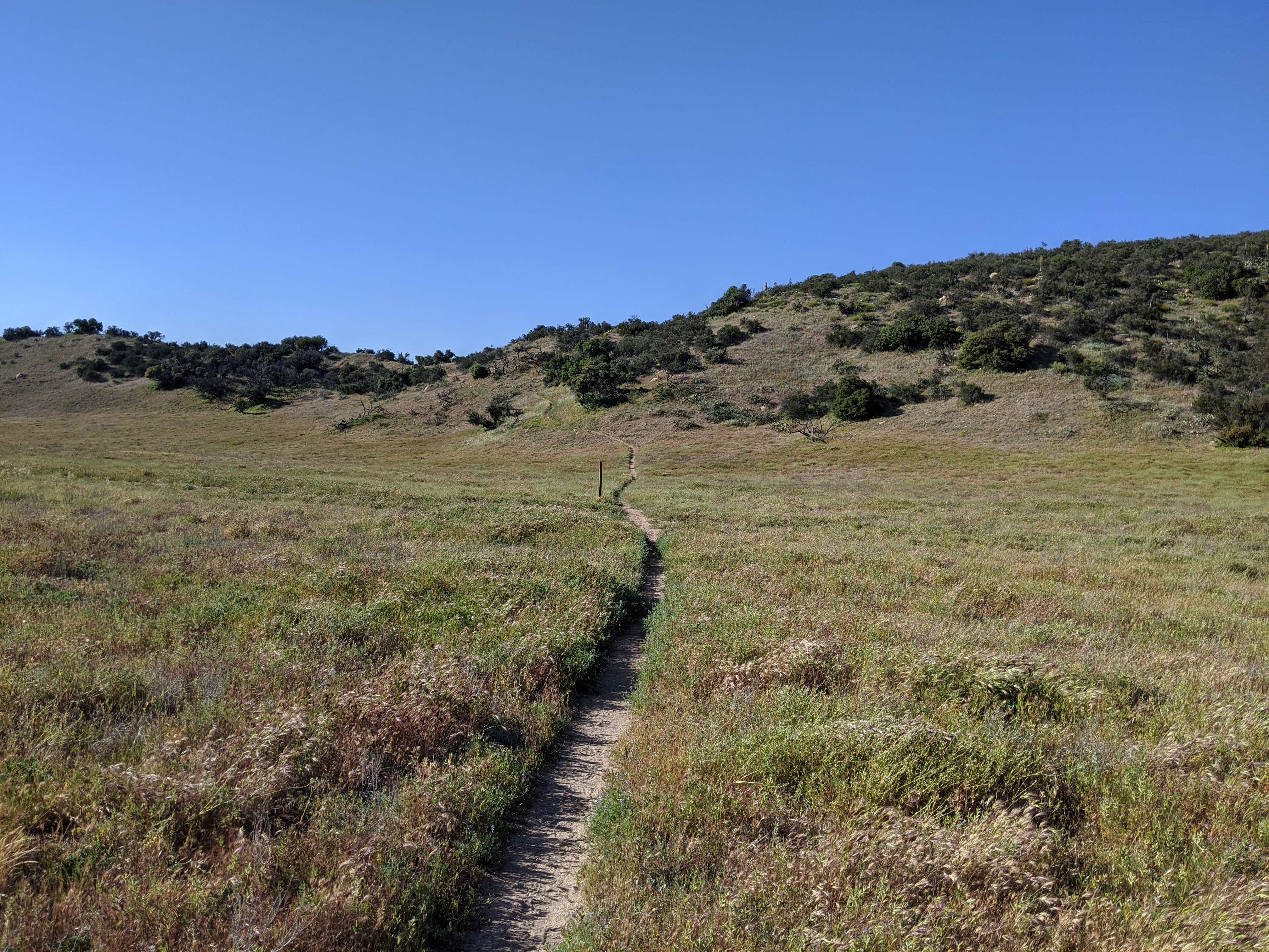
The desert is not flat. This was my first misconception. Here are a few photos for this section. 


I meet a few friends along the way. 

Young couple I meet on day 2.

My shadow that was with most of the time. 

I saw these dudes most everyday in this section. 

Gentleman who checks this water supple  here. 

Gal is fellow PCT hiker and guy is trail angel who gave us fruit and ice-cream. This is a real treat in places like this. 
Rock formation. I wish I could have jumped on and gone for a ride. 
PCT hiker Case and Momma Bear. MB is a trail angel that had soda, fruit and water for us. 
Giggles, I spent a couple days hiking and camping with him. 
Some Off road people that gave me a sandwich and snacks. 
At the bud farm. My new buddy.
At Action KOA. Fellow PCT  hikers. 
I saw lots of these. They did not want to sit still for photos very often. 
Part of trail family I hung with for a few days. Snack size, Joy ride, Pittsburg, Cinderella.
Pittsburg, Cinderella and Mother ship.


Trail family on LA aqua duct. Me, Pittsburg, Joy ride, Cinderella and Mother ship. 


Can you see me? This guy does not move unless you are going to step on him

A nice and slow fellow taking his time in life. 


One interesting thing about this section in getting water for yourself. I use 5 to 8 liters of water per day. Sometimes I had to walk up to 1/2 mile off trail, usually downhill,  to the water source. There were times when I had to walk 20 miles between water sources. There were sections where the water source was provided by some generous person for us PCT hikers. Without people like this, it would be a very long way between water sources. 

Nice easy source for water. 

Not as nice, but easy to access. I always filter my water. 

Note water bottles filled in the tub. These would be refilled once they were empty. 
Again, water in bottles to be refilled once we get what we need. Some of these places ask for a small fee to help with the cost. 
Water tanks at Mike's place with water for us. 
This is Mary's place. She had water, outhouse, portable shower and covered picnic tables for us. Her place comes after Mikes place. On this day all my water came from the generosity of people who own land on the trail. 
Kind of ugly. When you need water and will walk 1/3 of a mile down hill to get it, you do not complain. 
One of those water sources where I walked to get. I am thankful that they are here. A lot of these have a sulfur smell. 
Look what is around here. The gov put this source in for the hikers. Your tax dollars at work. 


An oasis in a very dry place. 
You make due with what is out there. Note all my supplies for getting water and filtering it. 
Generous people, thanks. 
One the springs on the trail. 
Mother ship and I getting water from a tank someone built. We had to pre filter the water first to get the floaties out before running it through our filters. 
One of the springs for getting water. 
Thanks to who keeps this water supply filled. It is a bit warm here. 

The last thing I want to show you from this section is some of the flowers and plants I saw along the way. I do not know the names of them. I would enjoy them every day on this section. The desert is a very beautiful place and harsh place. 


I finished this section on May 30 at mile marker 680.8 on the PCT. This is day 32 on the trail. 

Please stay tuned for more sections on my PCT journey. 


Tuesday, March 3, 2020

What I am bringing on the PCT


What I am bringing


In making the choices of what to bring, I considered cost, weight and convenience of each item. Someone doing a trip like this could spend more than I did and have less weight to carry.


As far as cost of gear goes, I used a lot of what I had already for this trip. I have been playing in the Cascades for over 30 years in all seasons.  Most items I bought were on sale. I was looking for well-rounded items I could use for other adventures in my life.


On weight, I am not a little person nor am I looking to set a personal best or a record of any kind in doing this hike. I lot of the lighter gear gives up some comfort and put you out there to hope for the best that all goes well. Having done much ultra-light adventures in the Cascades, I know what it is like to suffer to meet the goal of moving fast. I tried to find the balance of being light as possible and still able to enjoy what Mother Nature will throw at me for ~four months.


On convenience, the biggest question I asked myself was, does this piece of gear do what I need it to do? If the answer was yes, it is coming with me. We all have our fears in our life that dictate aspects of our lives. Preparing for this hike, how are my fears influencing what I am bringing? If you are an experienced hiker, you might think I have some items that you would not need. Having never done a backcountry outing over 10 days, I know I will pare down some items as I learn to adjust to what I need for the trail.


Item- (why I am bring it.)


Tent-Big Agnes Fly Creek High Volume UL 1 (I already owned it and it works for me)


Sleep system

Sleeping Bag-Patagonia 850 down 20 degree rating (I got it on sale and the temp rating is what I was looking for)

Sleeping pad-Nemo Tensor 20R mummy (discounted and it was the r rating I was looking for)

Nemo inflation bag/pillow/stuff sack (on sale and I did not want to blow up my pad every night for ~four months)

Thin light foam pad (It is my sit pad and I do not trust my sleeping pad 100%)

Mountain Smith sleeping bag liner, light weight-(I need to be warm to sleep; it will help keep my sleeping bag clean.)

Pack, Six moons designs, Minimalist-(Much research and going to PCT days to try different packs on.)


Cooking and water system

MSR pocket rocket-(It got good reviews)

Evernew titanium pot 900ml-(It was the size I was looking for)

Titanium spork-(It does what it is designed to do)

Swiss Army “Little Vicky” – (It does what it is designed to do)

Homemade cozy for my pot-(I like to keep my food warm)

Two Smart water bottles-(They fit on my water filter)

Sawyer squeeze water filter-(good reviews)

Four collapsible water bladders-(They take up little space and light weight)

Bear Vault BV500-(I am not willing to share my food with the bears in the Sierra)

UR Sack-(I am not willing to share my food with the other critters when not in the Sierra)


Gear to aid in travel over land

Ice axe-(I have had this for many years: used to travel on snow)

Micro Spikes-(I have had these for many years: used to travel on snow)

Black Diamond Z distance poles-(I have had these for many years: used to help with balance)

Umbrella-(Keep the sun and rain off me)


Shoes and such

La Sportiva Wildcat shoes-(They fit my feet well)

Darn Tough socks-(The standard for long trails)

Outdoor Research gaiters-(They work for me)


Electronics

Google Pixel 3 phone-(It has good battery life and takes good photos)

10,000 battery pack-(usb-c  for quick recharge, I hope this is enough juice for my phone and headlamp)

Spot gps messenger-(for calling help and checking in so others know I am ok)

2 port plug in for charging devices-(usb-c for quick charging)

I-pod-(I like my music, audio books and podcast to past the time)

Rechargeable headlamp-(This will be a huge saving in batteries)

Cords for all this stuff


Miscellanies

TP and duce of spades trowel-(One has to do their duty)

Repair kit-(to take care of my gear so it will not hinder my progress)

Small fire making kit-(You never know when you will need it)

There is probably many little things I am I will take that I am not listing here.


Clothes

Rain jacket and pants – (One has to be prepared)

Patagonia nano puff-(I have had it for many years)

OR light pile jacket-(I like to stay warm and my nano puff is not by itself)

Patagonia light vest-(I use this trail running a lot in cool weather, I figure it will do the job here)

Pants, shorts, tee shirt, long sleeve tee shirt, light weight long johns, sunhat, two beanies and some mittens. (These clothes are from my adventures of the past.  I figure if they did the job then they should do it now. )


This is not complete, but closes enough to get the idea of what I am carrying. The weight of what is in my pack is around 14 lbs. This does not include water, food, ice axe or micro spikes.

Monday, February 17, 2020

Pacific Crest Trail 2020


Hi All

I will be hiking the PCT in 2020. If you would like to follow me, here is the link for my SPOT gps device.

https://maps.findmespot.com/s/0N27

I will sent out a ok message every few days to show where I am at. I will update the blog as I have time and access to the internet with photos and information on my hiking.

If you would like to contact me, please text me on my phone. I will reply as I have time and access. I will give my phone number out to people I personally know.

Thanks for following me, reading my blog and looking at my photos.

Bye Jeff

Saturday, November 11, 2017

Moab 200

Moab 200


On Oct 12 at 6am I was standing at the starting line for the Moab 200. This is a 237 mile running event that travels in one loop through the mountains, valleys and plains around Moab Utah. It gains ~30,000 ft. of climbing over this distance. The high point on the route is 10.500 ft.
When I menschen that I have done this, I can tell most people do not have a reference for what I have done. To help with this, many years ago I completed a 50k run. The next year I completed a 50 mile run. The following year I completed a 100k run. I year or two latter I completed a 100 mile run. A year or two latter I completed two 100 mile runs one month apart. In 2011 I completed four 100 mile run in a three month period. Two years later I did one 100 mile run each year till 2016 and I did my first 200 mile run, Bigfoot 200. As you can imagine I did many training runs to get myself ready for each year’s goal.
To get ready for Moab, I did many solo, self-supported training runs in the cascades. The pinnacle of these training runs was a 100+ miler up by Ross Lake called Sourdough Suffer fest on the Ultra Pedestrian Wilderness Challenge FB page.
At 6am in Moab Utah in Oct it is quite cold. I am wearing many clothes I know I will be taking off very soon as the sun rises and I warm up from the running I will be doing. I have to carry with me what I will need to survive from aid stations to aid station at distances up to 22 miles apart. The temps I will encounter will range from teens to 80 with varying wind speeds. I can place items in drop bags that will be waiting for me at each aid stations that allow them. I have a crew of John with will meet me at some of the aid stations along the way
It is a little after 6 and I am running with the pack of 136 other people. In the beginning of each race I seek out the pace I wish to be at. It is single track and we are jockeying for our place to be at our pace.  As predicted, I have to stop two times to remove clothes and each time has to reestablish my place in the line. The first aid station, Hurrah is 15 miles out.  The running is easy and we are all finding our place and pace.


After Hurrah, it is 18.7 miles to Breaking Bad. It is getting warm now and there is a constant wind. I am not sweating due to the low humidity and wind. I have to be careful to keep the pace slow and remember to keep drinking. I have 90 oz. of water on me leaving Hurrah. I play a game of guessing where the trail goes next. The trail goes in and out of each draw as we contoured around this amazing beautiful terrain. There is no water out here. I wonder how the native people and explorers of past time survived.


I enter Breaking Bad out of water. Each of the people I pass by is experiencing the same thing. Luckily for me it was only the past 10 min. I fill up water wishing I had my second bottle stashed in a drop bag ahead. It is 22 miles to Hamburger Rock the next aid station.  I know I will run out of water before I get there. My only hope is that the approaching darkness and cooler temp to come will help.
Again, the running is easy; it is mostly off road vehicle trails. The sunset was amazing. The wind is a constant. I am yo-yoing with other runners along the trail. I do run out of water, but to my luck one of the other runners has half a bottle to give me that allows me to get to the aid station. My first drop bag is here. I change out socks, reload the pack and fuel up from the aid station before heading out to The Island 15.5 miles away. John is here to say hi and help as he can.


Night moving is different. I slow down as my world is now contained in the beam of my headlamp. I know there is a this amazing world I am traveling through. I trust the markers along the trail, my gps watch, gps app on my phone and a good dose of common sense to take me on the correct path.
When on a run on this length, you pass, get passed and run with other runner based on how you feel. This is true as I run with a gal for a while. At some point it starts getting light as we approach the next aid station Bridger Jack. It is Saturday morning now. In 18.5 more miles I will be at Shay Mtn.
On my way to Shay I spent a lot of time with Phil from CO. We would mostly run together in silence. We are approaching 8,500 ft. in this section. This was a nice section as it went through a valley. The terrain was different than the other areas. There are trees to shade the sun. I really enjoyed the change in terrain. I was getting beat up by the full sun and constant wind. After Shay comes Dry Valley. This was an interesting section as we were in a wash with a small stream for part of it. It got dark here. With all the tech and runner here and there, staying on route was easy enough without a trail under our feet.


Once at Dry Valley I took a 2 hour nap. It was quite cold here. They had a semi heated tent with two cots to sleep on I started in a chair then when a cot opened up I got to lay down.  It is sat night now and 121 miles into the event.
The next section to Wind Whistle is road, dirt then paved. I could look back and see a light or two in the distance from other runners. I got off the route on a side road but realized my mistake quickly and got back on course.  While on the paved road a car stopped and asked if I was ok. I said I was fine and asked what the temp was showing from their car. It read 20. I was wearing two layers on bottom and six on my top with two hats and one balaclava. All these were light layers combined to keep me warm. Two layers of mittens for the hands.
At Wind Whistle I put my head on my knees for one more hour of sleep sitting in front of the fire ring. One might think this is crazy, but to see people pushing it this far out there, this is quite common behavior.  


On my way to Road 46 aid station the sun came up. It is Sunday morning now. This is all dirt roads running. This part if the country is breathe taking watching the sky turn from dark to light.
I am at road 46 now and Mike M and John are there. Mike is going to run with me for the next 34 miles. Pole Canyon is next at 17.3 miles away. We will spend a lot of time climbing to the high point of the course at 10,500 ft. coming up after Pole Canyon. This section is quite open and lots of sun. Runners come and go. We share the aid station with 8 other runners. The crew tells us of how it got down to 8 there last night. Once we all hear this story we all hustle out of there as darkness is a couple hours away.


If I had a low point in the run it would be on my way to Oowah Lake. I was getting whipped out. I was into the event 166+ miles approaching 10,500 ft. and it is night three coming on. I had a slow mile at 55 mins in this section. Luckily what goes up comes down and with Mike leading; I could follow his feet in the night traveling faster than I could have on my own. After too much time we arrive at Oowah Lake. We were both whipped out. It is cold out now. I eat and go down for three hours of sleep.


I wake up Monday morning ready for traveling to Porcupine Rim with John.We start out running through this amazing Aspen forest. The sun is still low and the light is something else. After a while we are on a dirt road for easy travel. The views are breathtaking as we are working our way slowly down into the valley.Once at Porcupine Rim I bid John and Mike goodbye and head off with the MT bikers down the trail. Sections of this trail parallel the rim with great view of the valley floor. If you are in this area, this is a must do trail. After a while I am at the end of this section for a short paved bike trail. It is becoming Monday night. I experience a party boat on the river with the canyon walls being lite up for them. I do not know this until I come across a couple that walk with me to the aid station, Arches mile 220.


Mike and John are at Arches to greet me. Refuel and I am out with John for the final 17 miles. We work our way through town to the trails. Someone had messed with the markers leaving us to find out way to the route. It was not a problem and I have everything I needed. The trail contoured along the hills till the water stop. We then went up and over to the slick rock section. This was unreal to walk up and down slick rock that I know the rock here in the PNW would not have this traction.


The last section is along the road leading into the camp ground. I get there 94 hours and one min after leaving Friday morning. It is 5:01am Tue morning and I am tired, time for me to get some sleep.